Friday, September 1, 2017

California Day 8...At the Stroke of Midnight

Friday 8/18/17

    At the stroke of midnight I was awakened by a familiar ding, ding, ding, ding sound.  The back of the Knights Inn sits along a set of railroad tracks.  The train engineer’s four horn blasts warning of a road crossing did the rest.  Even in the motel’s bed I could feel the vibration of the train as it worked its way past. Fortunately, the next one to come through was 7:30A. By then I was already packing up the room.
     Hwy 199 took me out of Grants Pass.  Just for kicks, I stopped for gas.  I really didn’t need it, but here in Oregon they pump it for you.  The attendant even cleaned my windshield.  Not too bad. Besides, I knew the price would go up as soon as I crossed the state line.
     Speaking of crossing the state line, I knew there would be an agricultural checkpoint, so I made it a point to finish everything before crossing.  Unlike the last few times, the guy simply waved me through. 
     While it was nice to put the smoke behind me, I drove into a fog bank as soon as I approached Crescent City, California, my home for the night.  My motel was right on Hwy 101 and I saw it as I drove past.


      My goal was a few miles south.  I was looking for the turnoff for Requa Road. Two miles up the road is a small parking lot and a trail down to Hidden Beach.  I had heard raves about this trail and the views.  Considering the view from the parking lot, I wasn’t holding my breath,


    Hidden Beach is three miles down a forest path that alternates nice and wide to thin and vague.  It was actually a nice walk, especially considering I had been in the car all morning. 


    At about a mile down the trail I started hearing seals barking down below,  Of course I couldn’t see them.  I couldn’t see much of anything beyond perhaps a hundred feet.  Eventually I did start hearing the crashing waves below and the trail began to level off.  I picked my way over some very large pieces of driftwood onto the beach.


     Sure, the view isn’t what I had seen on line and heard people rave over, but I did realize I had the damp, chilly beach to myself.  


     This was the first encounter with a driftwood teepee on this trip.  But, it certainly wasn't my last.  They ranged from perhaps two feet to eight feet tall.  It must be a west coast thing.


     On the way back up I did pass two small groups heading down.  I didn’t stop for photos since, let’s be honest, there wasn’t much to see.
     Once again I worked my way through the four construction zones and back to Crescent City.  I checked into the Front Street Inn.  It’s an older motel, but clean.  My only issue was the overwhelming damp feel.  One night was fine, but I wouldn’t have wanted to do an extended stay.   
     The sign on the corner said the motel was twelve blocks from the lighthouse.  It was late in the afternoon and I had no other plans for the day, so I grabbed the camera and started walking  Across Front Street sits a large municipal park.  It had plenty of people milling about.  It would be closed off in the morning.  But, not for any reason I would have guessed.
     Three blocks down I passed a bar with a For Sale in the window.  The sign out front claimed it was one of the “cleanest bars in the pacific northwest.”  I’m not a fan of filthy bars, but it did seem an odd selling point.
    I few blocks further I passed a place called SeaQuake Brewery.  They have a bar and restaurant attached.  So,  I went inside. Among their own craft beers was a chocolate porter.  I’ve tried quite a few porters and usually enjoyed them.  The toasted porter was still a favorite.  The vanilla porter had been surprisingly good.  This was my first chocolate one.  There was no chocolate flavor at all and in all honesty it did nothing for me. 


     So, I walked down to the beach with an hour or so to sunset.
     The Battery Point Lighthouse does do tours, but as the sign says, it’s only accessible during low tide.


       In 1855, the ship America burned in Crescent City's harbor.  Three cannon were salvaged from the wreckage and placed upon that rock.  They were never fired in anger, just the 4th of July and other special occasions.  Thus the name Battery Point.  Based on the look of the clouds, sunset could have been spectacular or a bust.


      There are a few signs near the base of the jetty warning walkers it can be slippery.  There’s even an easily bypassed barricade.  Families were even walking up and down.  So, I hopped the barricade and joined them. 


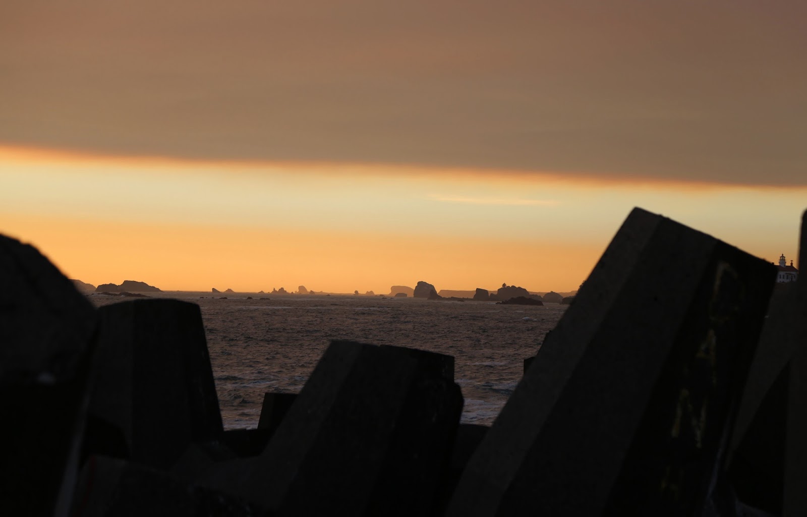
      These oddly shaped concrete shapes are stacked at the end of the walkway.  That's where I stopped.  There were a few fishermen who had climbed over them.  I wasn't feeling that bold.  At the end of the jetty sits the harbor's fog horn.  It was going off at regular intervals the entire time I was in town.


      As the sun set the other walkers slowly began abandoning me.  Once again, I had the place to myself. 


     With the last of the colors fading, I hopped over the jetty's barricad and started walking home. I did stop back into the brewery again.  This time for a Blonde Ale that was just superb.   The chatter around the bar seemed centered on the A’s and the Raiders. 


California Day 3, Regrets...I Had a Few

Sunday 8/13/17
   There are four entrances to Lassen Volcanic National Park.  I booked the room in Susanville only because it’s the closest town to the northeastern entrance and east of the park.  Unlike the last time I visited, I wouldn’t be making the drive staring into the morning sun.  Life lesson learned.
    Upon arrival in the park the day before, I discovered Hwy 36 had some long delays west of the park due to construction.  So, as an added bonus, I missed all that.
     The day was going to be a long one, so I was up and out around 6:30A.  Breakfast was a Cliff Bar and a coffee as I drove out of Susanville.  On the outskirts of town I picked up Hwy 44 for the thirty mile drive to the park entrance.  The turnoff was well marked and the six miles of gravel road to the trailhead was a breeze, albeit a dusty one. 
     I supplemented my Cliff Bar with an apple and started down the trail.  The first 1.3 miles was along a path of fine black gravel. No surprise considered the lava field alongside the trail.  The lava field ends as you’d expect with the base of the volcano.


    This one erupted sometime in the 1600’s.  There’s a trail up one side and down the other.  And yes it’s as steep as it looks.  In addition, it’s all loose volcanic rocks, so it’s slow going. 


   How steep you ask?  That's the trail in the foreground.  In the background is Lassen Peak.  I hiked up it's side the last time I was here and enjoyed the challenge of hiking up a snowy mountain trail.  I could have revisited that trail, but chose to do something different.  As I climbed the side of the cinder cone I had many regrets of my choice.  It seemed for every four feet I would slip back one.  It made for slow going, but the view from the top was worth it.   To make it official, I dusted off my protractor.  It's 35 degrees.  


   I finally made it to the top and was greeted by a rather cool, welcoming breeze.  I ditched my trekking poles and pack, dumped the gravel from my boots and just took it all in.   


​
​   To the south of me was the large lava field I had hiked past.  To the west of me was a place they call the Painted Dunes.  They're not actually sand dunes.  They just look that way.  In actuality it's colored gravel.


There was a trail down into the base of the volcano’s cone.  I’ve climbed down into a few over the years.  Been there, done that.  I didn’t climb down into this one.  Instead, I pondered which trail to take downwards. 
      The trail on the back side of the volcano looped around over the painted dunes, so I chose that way down.  Thank goodness for the trekking poles.  The trail down was just as steep as the one going up.  Unlike the loose gravel on the other trail, this was loose stones and it made for an interesting trip down.  I was leading with the poles and watching every step of the way.


​

​


      From the base of the trail I had numerous choices.  I chose to hike further south and do the loop trail around Snag Lake.  It was a little over a mile to the lake, with the lava field an ever present companion on my left. 
      This is the northern end of Snag Lake, formed by the lava flow coming to a halt and blocking drainage.  It was about a mile to the southern end of the lake.  My plan was to reassess my plans at the trail juncture at the base of the lake.  I could add another mile and a half to another lake, turn around or hike back along the eastern side of the lake.


 The trail around Snag Lake would eventually take be around the southern tip of the lake,  At the trail juncture I had the choice to continue and add another two and a half miles to my journey by visiting another lake, or taking the trail that would eventually bring me back to the eastern shore of Snag Lake.  I decided to forego the extra lake and continue on the loop.  


    A quarter of a mile back up the trail, the map indicated a bridge over the stream.  It didn’t indicate the bridge being out.  I really didn’t need to see this.  BY now you know water crossings aren’t exactly my forte.  Yeah, I could have hiked in the snow.
    So, I shoved my camera inside my pack just in case and scouted my choices.  If I crouched down I could still use my poles for extra balance crossing that tree. I could do this.   As it turned out, this was just a warm up for the surprise I had much further up the trail.


         Back on solid ground again and suddenly feeling much better, I started walking north, back towards the trailhead, seven miles away.   The first stretch stayed close to the lakeshore.
    At the head of the lake the trail headed inward to some rolling hills through the forest.   That's the lava flow and cinder cone from earlier.
​


    The sign at the next trail junction said a mile and a half to the parking lot.  Whoo hoo!  The celebration turned out to be a little premature.  But, the water break was welcome.
    With .9 miles to go I came to a sign.  If I kept going straight it was 1.4 miles via Bathtub and Coy Lakes.  If I went left it was .9 miles via the “Lakeshore Trail.”  Well, I could have cross on the conveniently larger downed tree. But, that wall of lava rock came right up to the lakeshore.  I didn’t see any trail on the other side and didn’t feel like climbing those rocks. 


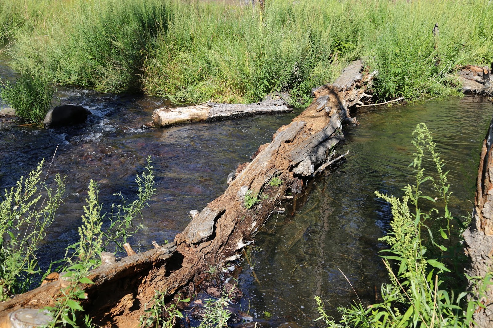
   So, I resigned myself to the extra half mile.  My body was already aching at this point, but I had little choice.   I did find the sign indicating the stream crossing.  Once again there was no bridge, just a tree.  Unlike the earlier one, this one was partially rotten and soft underfoot.   This was not going to be fun.  Plus, there were those knots to step around. Joy.  I took it slowly and made it across without incident, though a few chunks of the tree did come off along the way.  


   Unlike the last crossing, I didn’t get much of an emotional lift from this one,  Though the last crossing was met with a park service bridge made from a log sliced lengthwise. 
     The last half mile of the day was just putting one foot in front of the other and trudging onwards.  I didn’t have the energy to even walk down to the lakes. I just took a few shots from the trail and moved on.
​


     Fourteen miles after starting this journey, I finally made it back to the car.  I took my boots off and lay across the backseat letting them breathe. 
     By the time I had worked my way back to Susanville, all I wanted was a hot shower, a light dinner and a cold beer.  I knew just the place.  I had passed the Pioneer Pub on my way out of town and figured it would be perfect.  I wasn’t taking into account that it was Sunday.  The only places open near the motel were the fast foot joints and the Mexican place next door.    Fortunately, the IGA grocery three doors down had a deli.  The chicken sandwich fit the bill.  
​
Coming Up on Day 4
Out of the blue... a subway sign

California Day 1-2, The Mystery Wall

Greetings One and All,
   
     I'm just back from two weeks exploring California.  It started out as a visit with my sister in San Francisco with a few days to explore the bay area.  Then I started thinking about a return visit to Mammoth Lakes and the Devils Postpile National Monument.  The season is very short in the park and it’s been closed every time I’ve been close by, including May of last year.  https://www.nps.gov/depo/index.htm
       Another thought was Mount Whitney.  It’s located just outside Lone Pine.  It’s the highest point in California and the highest in the lower forty-eight states.  Then I read a few hiking websites.  It’s eleven miles each way with an elevation gain of 6,800 feet, ending at 14,494 feet.  Three different websites warned against trying to do it in one day.  One went so far as to warn “such large elevation gains in a single day can easily lead to pulmonary or cerebral edema, which can be fatal.”  Perhaps another time.  Chances are pretty slim I could have pulled that off in a day anyway.
     But, in the end I did manage to explore one more national monument and one more national park.  I did a lot of driving to and fro, but saw some amazing things.  I also met a woman named Courtney who single-handedly saved me from what could have been an utter disaster and another who was relieved I wasn’t a white supremacist and insisted on giving me a big hug.  Yes, it was that kind of trip.
   
Day 1 Friday 8/11/17

    Fortunately, I was covering an early schedule all week and clear at 2P.   So, I booked myself on the 6P flight out.  I may have been able to catch the 3:30P and certainly would have preferred it, but it would have been a little close to be safe.
    A couple of months ago I went through the process to get Global Entry.  It’s an expedited reentry service through Customs and Immigration.  So, the next time I fly outside the country  I’ll just have to scan my passport and fingerprint at a kiosk and I’m done.  No more waiting in lines.  It also comes with TSA Precheck.  This was my first time using it.  The line in Atlanta was longer than the line for regular passengers.  So, I used the regular line heading out.  Leaving San Francisco I didn’t need to remove my tablet from my bag.  Nor did I have to go through those body scanners.  Just an old school metal detector, complete with my sneakers still on my feet.  Sweet!
   There was a little kid in the middle seat, She was out cold shortly after take off and slept the whole way.  I was jealous.  At we flew west, we eventually flew into the sunset.  It was directly ahead so the bulk of the colors were obscured.  But, the light was turning the tips of the clouds a radiant gold.  I tried shooting the clouds through the plane window.  Shooting straight out the window was nothing but wing.  Shot at an angle, the plane's window made it even more interesting.  


    My home for the night was the America’s Best Value Inn in San Mateo, just a few miles south of the San Francisco Airport.  It was nothing special, just a place to crash for the night and the location was just right.   It was clean, but nothing to write home about. So, I won’t.

Day 2 Saturday 8/12/17

     Just a few blocks from the motel sits Seal Point Park.  In the 1930’s the land where the park currently sits was a municipal dump.  Everything was left here from generic city trash to the muck dredged from the bay, to incinerator ash from the water treatment plant.  The smell was apparently legendary. 
      In 1982, the city of San Mateo decided they really needed to do something about it.  Nothing became of it for a few years until someone proposed a bicycle trail around the edge of the bay.  But what to do about the pile of trash in the middle.  The first idea was to simply bury it under four feet of dirt.  But, that held its own problems.  Instead, they basically wrapped it in plastic and then covered it.  One sign in the park mentioned the height of the trash as over eighty feet.  Thus the large hill in the center of the park.
     The trash is still there and the city monitors the air and groundwater continuously.  But, that’s not why I came here.  Among the scattered methane alarms sit a collection of sonic sculptures.  They’re designed to hum and sing in the breeze.  
     There was a light breeze coming in off the bay.  Apparently not enough of one though. The sculptures were silent and the one clearly designed to spin was sitting still.  
​
​


    I left the park, crossed the San Mateo Bridge and went in search of Tilden Regional Park, outside Berkeley.  Sure, it was out of my way, but last month I came across an article about mysterious structures around the United States.  When I read about the Berkeley Mystery Wall, I had to check it out. 
     The wall isn’t continuous, but contains segments that stretch over fifty miles.  The height of the wall segments goes from two feet to as high as five feet and are made simply of stacked stones.  Adding to the mystery are a couple of stone circles in the area around Mt Diablo.   
      The first Spanish settlers to the area reported the walls already there.  The settlers asked the local Ohlone tribe about the walls and they said the same thing, they were already there.  Of course there are plenty of theories, from ancient Mongolian settlers to perhaps crew from Sir Francis Drake’s expedition circumnavigating the globe in the 1570’s.  But, in the end no one really knows.   You can read more about the wall here:http://www.messagetoeagle.com/enigma-of-the-ancient-berkeley-mystery-walls-the-great-wall-of-california/  or click here for a video:  https://www.youtube.com/watch?v=kFynMpg4QRM
    The park overlooks the city of Berkeley and I had to cut through to get there.  After the scant breakfast at the motel, I stopped into Berkeley Bagel for pretty good cranberry bagel, juice and another coffee.
     I found the park and picked up a map.  There was no reference to a stone wall and none of the trail names referenced it either.  It’s a city park, so there was no information desk to ask. So, I never did see the wall.  There are other places you can reportedly see it and they'll have to wait until the next time.  I did however get out and walk around a bit.  


     Not much was blooming in the park’s botanical garden.  There were plenty of small signs identifying many of the plants.  Of course the one with the biggest flowers had no sign.


​
​     I continued through the park and stopped at a small lot with an overlook named Inspiration Point.


​
​   The original plan was to drive from the park east to Oakhurst for three nights.  The town sits just outside Yosemite National Park.  I didn’t win the lottery for Half Dome access, but I had two long trails picked out. 

       That all changed three weeks out.  The Detwiler Fire was burning right where I was headed.  At that point it had burned some homes and businesses in Oakhurst and caused the evacuating of Mariposa, a few miles north.  The fire had also forced the National Park Service to temporarily close one entrance to the park, the one outside Oakhurst.  Visitors to the park were posting photos of Yosemite Valley full of smoke. 
      I realized this was still three weeks out and a lot can happen in that time.  The idea of hiking in the lingering smoke held no appeal.  Between the idea of breathing in the smoke all day, the uncertainty of the fire and it’s smell, I decided to change my plans. I cancelled my reservations and started looking at maps.   
​       A couple of years ago I spend  few days in Lassen Volcanic National Park and loved it.  There was just one full day loop hike I didn’t have the time for and really wanted to do.  So, instead of heading east, I left Berkeley and drove north.
      While I truly prefer to stick with the state highways and local roads, this was my one day with a long drive.  I picked up I-80, avoided Sacramento on I-505 and eventually picked up “The Five’ northbound all the way to Orland and picked up Hwy 32 eastbound.  The drive took me through some obvious old lava fields, and eventually through Lassen Forrest.  I thought about a five mile side trip to Butte Meadows. The town name intrigued me.  I checked out photos of the town on line and never saw a butte, just a few meadows and cabins.
       Hwy 32 dead ends at Hwy 36.  I drove west to the entrance of Lassen Volcanic National Park.  By the time I pulled into the visitors center it was already 5P.  I thought about a waterfall trail.  But, I was also thinking of the sixty mile drive to Susanville.  Instead, I just took a trail by the visitor center twenty minutes out, then turned around,  It felt good to be walking


   I left the park and drove east towards Susanville.  I had read about the “Westwood Chimney” and when I saw it I stopped to check it out.  At first glance it's just a chimney from an old house.  The story goes, in 1992 a group of locals decided to meet at the chimney for a Christmas party.  During the course of the evening they decided to give something back to the community.  The Chimney Fund was born.  It's goal was to help those in need at Christmas time.  That year they collected enough food to distribute twenty baskets.  Over time the fund grew and included Thanksgiving.  Now they also include those in need of food year round.  All because some friends decided to meet at the old chimney.


​      I timed it all just right, I did manage to make it to the Diamond View Motel before dark.  I booked here because of the location and the price.  It’s a small, eight room motel tucked away on Main Street.  The rooms are small but very clean.  Unfortuntely, they don’t do breakfast.  I asked if there as somewhere in town I could get breakfast.  They told me, “just McDonalds.”  Fortunately, I had picked up some Cliff Bars and apples earlier in the day.  They would do for breakfast.
       Susanville was originally named Rooptown after Isaac Roop, one of the original settlers.  It was renamed after his daughter Susan.  Founded as farming, mining and lumber community, the biggest employer these days are the three prisons.  The state runs the California Correctional Center, a minimum security facility, and the High Desert State Prison, a high security facility.  Just down the road in Herlong is the Federal Correctional Institution.  So yeah, a whole lot of prisoners.  But, it also meant quite a few local, state and federal law enforcement personnel milling around. 

Coming Up on Day 3,
Regrets