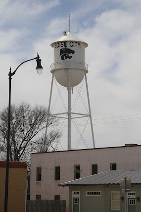
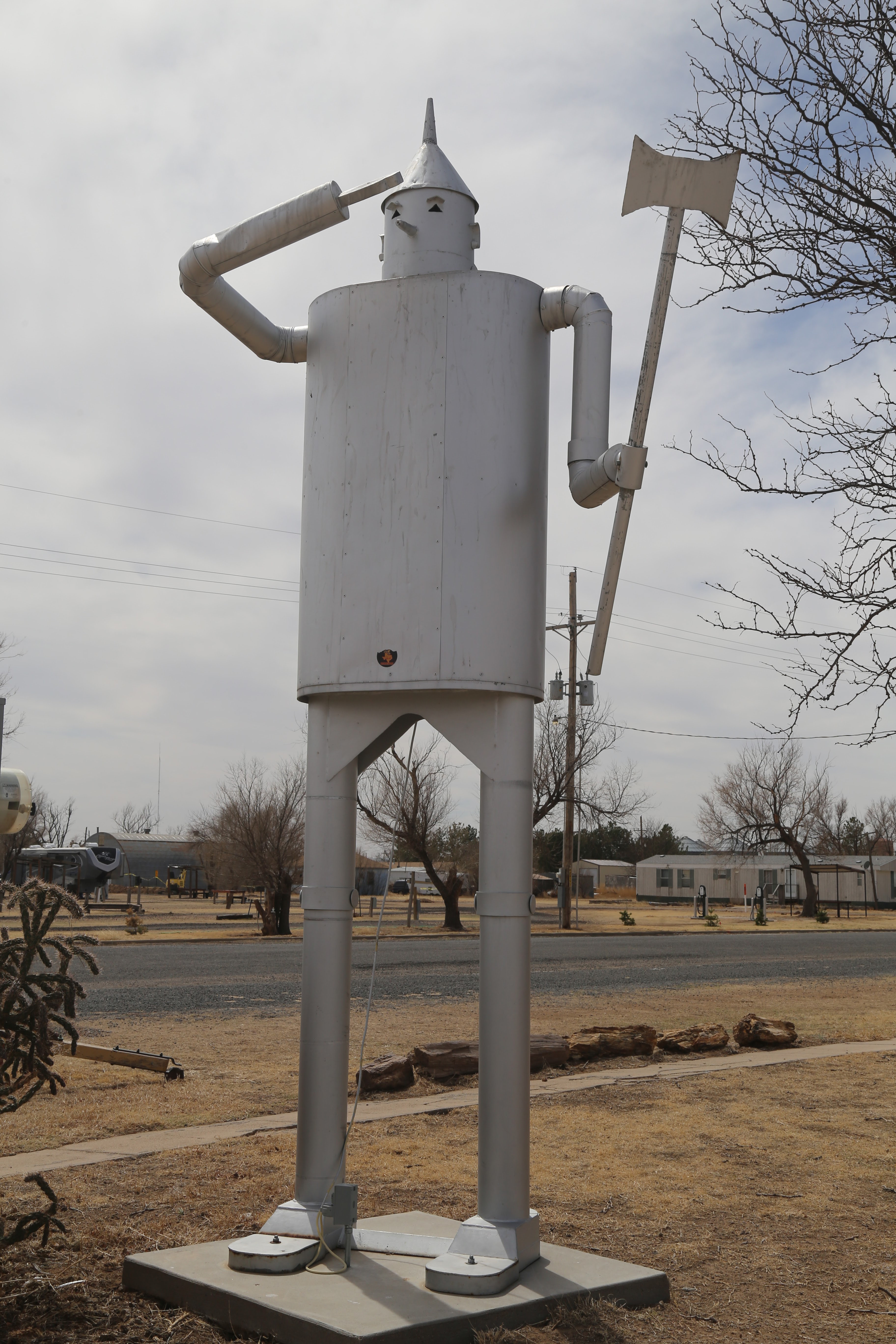
Day 3
Monday April 4
With no reason to hang around Boise City, I was up and out nice and early. There's a small place a few blocks up from the motel that's open for breakfast nice and early. With a pleasant chill in the air, I decided to walk.


The Blue Bonnet Cafe doesn't have a website, but it's your typical small down place. The staff called everyone by name and treated me like a regular. It was a pretty standard breakfast. And yes, one of these days I will actually learn to ask how big the pancakes are before ordering a side. When they're thick and the size of a dinner plate, it gets a bit much.

Highway 412 took me west to the state line and into New Mexico. I must be slipping. I also missed the opportunity to hit the tri-point of Oklahoma, Texas and New Mexico. The state’s name actually predates the naming of the country of Mexico by two hundred and fifty years.


There are numerous versions of where the “Mexico” comes from. When Spain conquered the region, and renamed it New Spain, they called the capital city Mexico City. When they won their independence from Spain, they simply named the whole country Mexico.
Spain had been sending their own explorers across the Rio Grande. The area they were mapping was simply named New Mexico. By the late 1590's, they were organizing caravans of settlers into the area.
Hwy 412 took me west through the town of Clayton, New Mexico, named the “most haunted town in New Mexico” by the state’s tourism board. On the outskirts of town, I saw a familiar site. Paralleling the highway was the obvious track bed of a long abandoned railroad line. They're scattered across the countryside. This was the Elkhart and Santa Fe Railroad connecting Boise City and Clayton. The line was abandoned in 1942.

Right on Main Street sits the Eklund Hotel. Originally opened as a saloon and gambling hall in 1892, it was purchased and expanded by Carl Eklund two years later.

The current owners claim the ghost of a maid has been seen in the hallways near Room 307, as well as guests hearing footsteps. They call her Irene and consider her harmless. Their favorite story involves a guest who arrived with a migraine and went to the room to lay down. In the dark, she felt her husband gently rubbing her head, and the pain eased. He denied having done anything, or even being in the room.
The Union County Courthouse is also said to be haunted by the spirit of Tom “Black Jack” Ketchum. After four years of train robberies and murders, he was eventually caught and convicted of “felonious assault against a railway train.” There have been reports of sightings of Ketchum, easily identifiable by his moustache. His jail cell has also had reports of it being oddly cold.
As for Ketchum, he was the first and last person ever executed by hanging in Union County.
The Luna Theater originally opened as the Mission Theater in 1915. It seats four hundred and as you can see, it's still in use today. You can watch a short documentary on the theater here:


Hwy 421 would eventually bring me to the town of Springer, where I picked up I-25 South. I took the exit for Red River Ranch Road, and continued south along Old Hwy 85.
I was looking for what was left of the town of Colmer. The name comes from its being on the border of Colfax and Mora Counties. Established around 1890 as a ranching community, its population never climbed above 450 residents.
In 1929, the Atchison, Topeka and Santa Fe Railroad began building a line that would pass through Colmer. Two years later, with the line only half built, it was abandoned. When I-25 bypassed the town, it couldn’t hold on any longer.
When I read about the place, I saw plenty of No Trespassing signs. I've encountered this before and am perfectly fine shooting photos from the streets. But, when there's a Private Property sign at the head of the entrance road, I tend to move on.


I stayed on Hwy 85 for quite some time before I could get back onto the interstate in the town of Wagon Mound, named after a butte in the shape of a Conestoga Wagon.
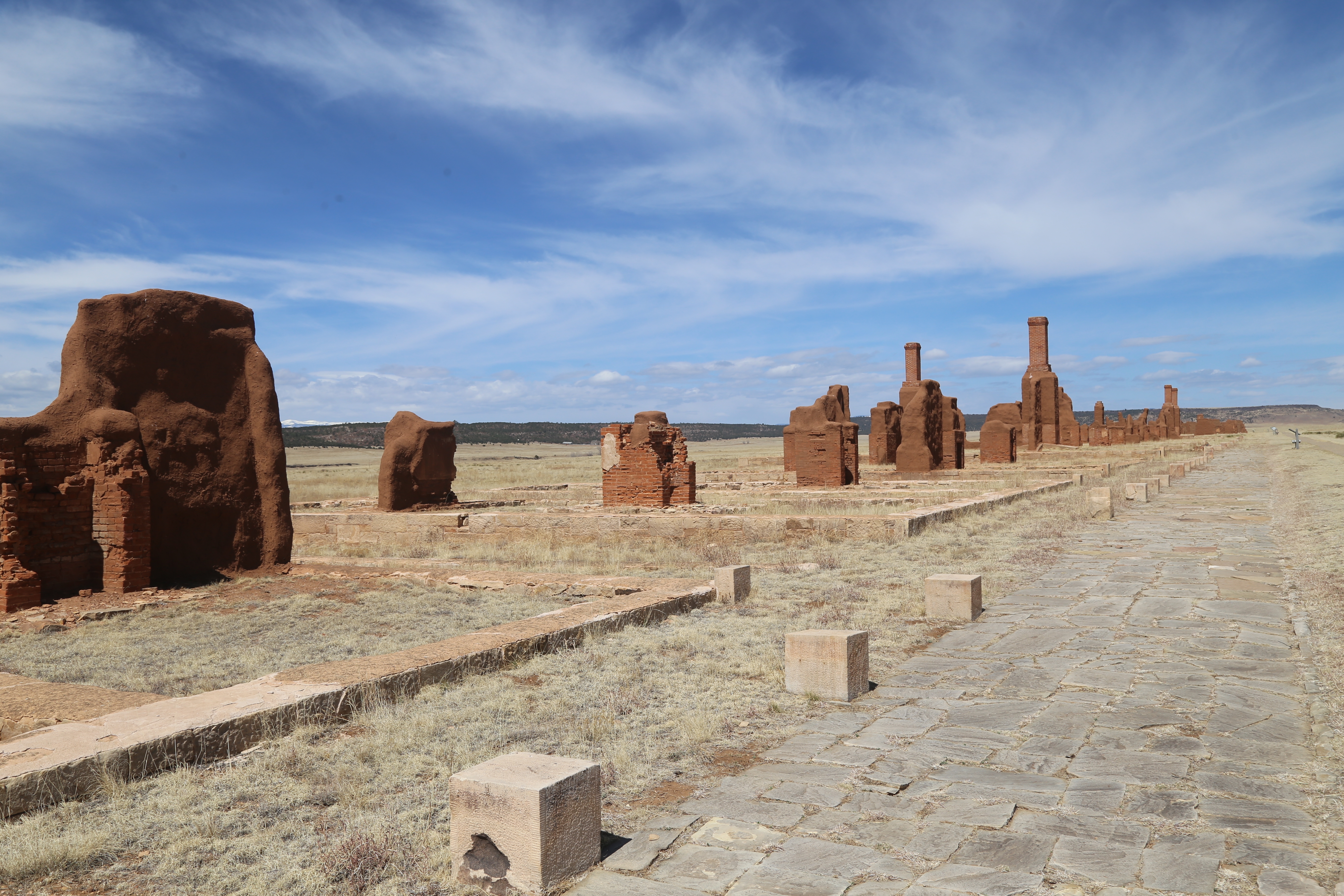
Just before the town of Waltous, I pulled off to check out Fort Union National Monument. The decaying adobe structures are part of the third fort built in this area. The first, built in 1851, was established at the base of the mesa in the distance and isn't accessible to the public. The main purpose of the fort was to protect the Santa Fe Trail from raids by neighboring tribes of Apache and Utes.

When the Civil War was looming, a second, earthen fort was built and fortified with cannon. It was completed just in time. Confederate forces had already invaded southern New Mexico and moved as far north as Santa Fe. Fort Union stood between them and the gold fields of Colorado.


The two sides met in battle west of here in late March, 1862. Union forces defeated the Confederates, destroying their wagon trains in the process. They had no alternative but to retreat back to Texas.
With the threat over, work began on the third and final fort on the site. The wooden structures on the original site didn't stand up to the weather, so the decision was made to use locally available adobe.
This fort was staffed until 1891. Twelve years prior, the Atchison, Topeka and Santa Fe Railroad had been completed and traffic on the old Santa Fe Trail started trickling off.




After leaving the fort, it was time to head south towards Las Vegas. Originally named Nuestra Senora de Los Dolores de Las Vegas Grandes (our Lady of Sorrows of the Great Meadows), the town was first settled in 1835.
The Mexican government approved the land grant with the idea of creating an entrance station into the country along the Santa Fe Trail, which had opened only twelve years prior. A well used Native American trading route, it connected western Missouri and Santa Fe, with goods traveling in both directions.
My first stop was the old railroad station. Built in 1899, it’s now a tourism office.

Just up the street is the old Hotel Castelaneda. Some of you might recognize it as the enemy headquarters from the 1984 film, “Red Dawn.” The Acheson, Topeka and Santa Fe Railroad built the hotel in 1898. It rarely made a profit and was shut down in 1946. The hotel remained abandoned until 2015 when it was purchased, restored and reopened in 2019. You can see some of the exteriors of the hotel in this clip from "Red Dawn."


I was starting to think about lunch when I saw the sign. Lunch at the Hotel Castaneda would be perfect. Inside the lobby, they told me they were closed for lunch on Mondays and Tuesday does to staffing issues.
It was too late for people to be checking out, and too early for check-ins, so the lobby was quiet. The nice woman working the desk offered to show me around the lower level. She unlocked the main dining room and told me the vast majority of the furniture was original to the hotel, as well as the original tin ceiling.
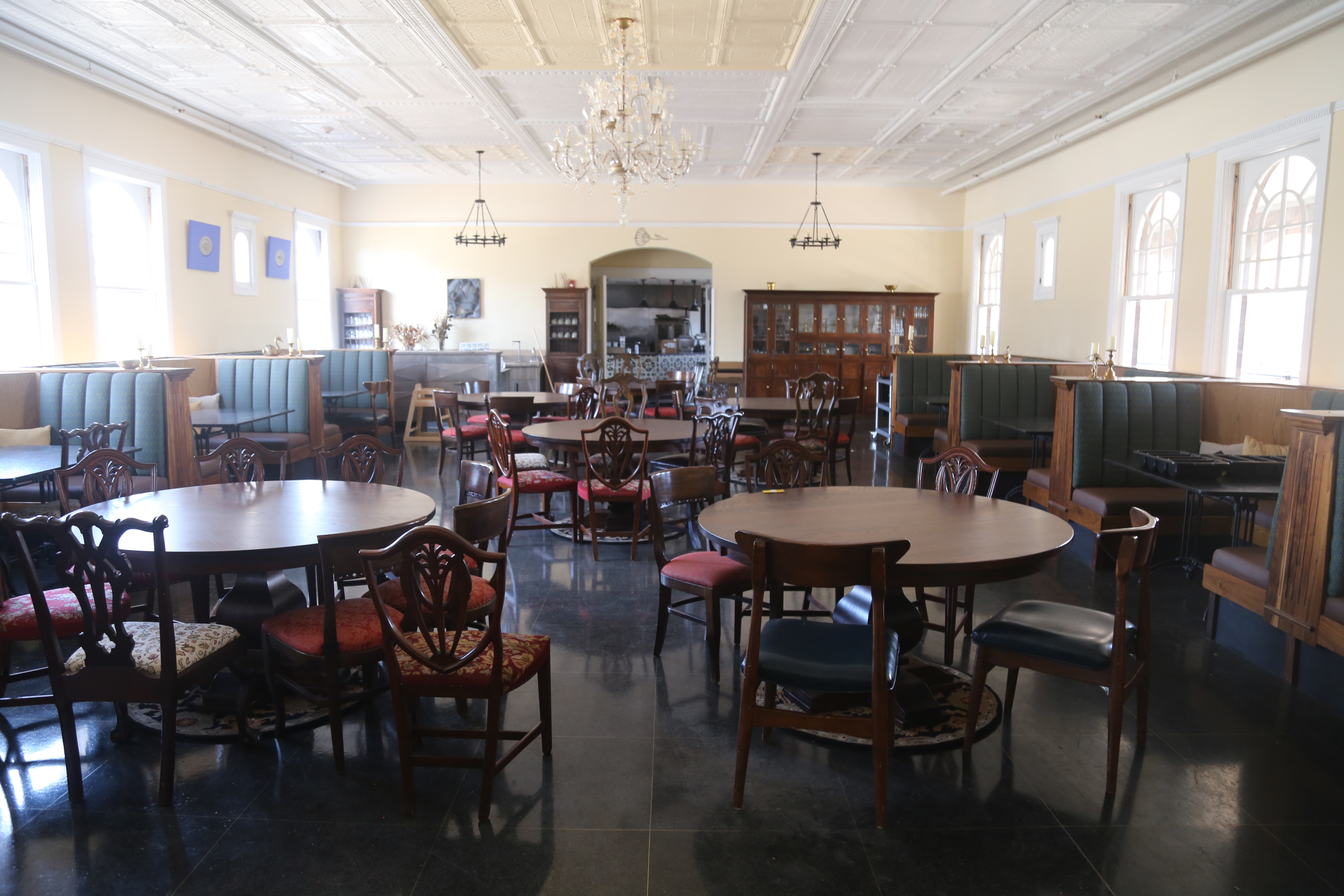
Likewise, the furniture and bar are also original to the hotel.


The film “Red Dawn” took place in a fictional town of Calumet, Colorado. There’s still the mural on a building downtown. You can see it in the film's trailer at the :54 second mark.

The afternoon was waning, and it was time to move on. I-25 took me west for a brief stop at the Pecos National Historic Park. Native American trade routes had long passed through the the area. The Pecos people built a community here that quickly became a trading center. The Pecos to have five hundred warriors and quickly became the dominant power in the region.
They built their community atop a small hill, with a clear view of the countryside.

The Pecos lived and traded here for about two hundred years. The community began to grow. Then the Spanish showed up. They didn't just try and colonize the land, they also felt obligated to try and convert the locals to Catholicism.
The Pecos believed their ancestors arose from the ground, and one way to get close to them was to go below ground. They build wide, circular pits and added a roof. In the center was simply a ladder down. They called these Kivas.

When Franciscan Friars insisted these be destroyed and replaced with a christian mission building, resentment began to rise. In 1680, Po'pay, a Pecos religious leader started planning an uprising. He visited the various pueblos in the area to explain his plan. He presented each with a knotted rope. Each knot represented a day.
On August 10th, the last knots were untied and everyone rose up together, driving the Spanish out. They would return twelve years later and adopt a less harsh approach to the Pecos. It worked, and together they built a church, ad even larger one twenty-five years later.
The old foundation is in the foreground. Remnants of the new church in back.


On into Santa Fe, the oldest state capital in the United States. The Spanish named it the capital of Nuevo Mexico in 1610. The second oldest capital city is Boston, which received the designation in 1630.
As was the style of the time, cities established by Spain were all build around a central plaza.
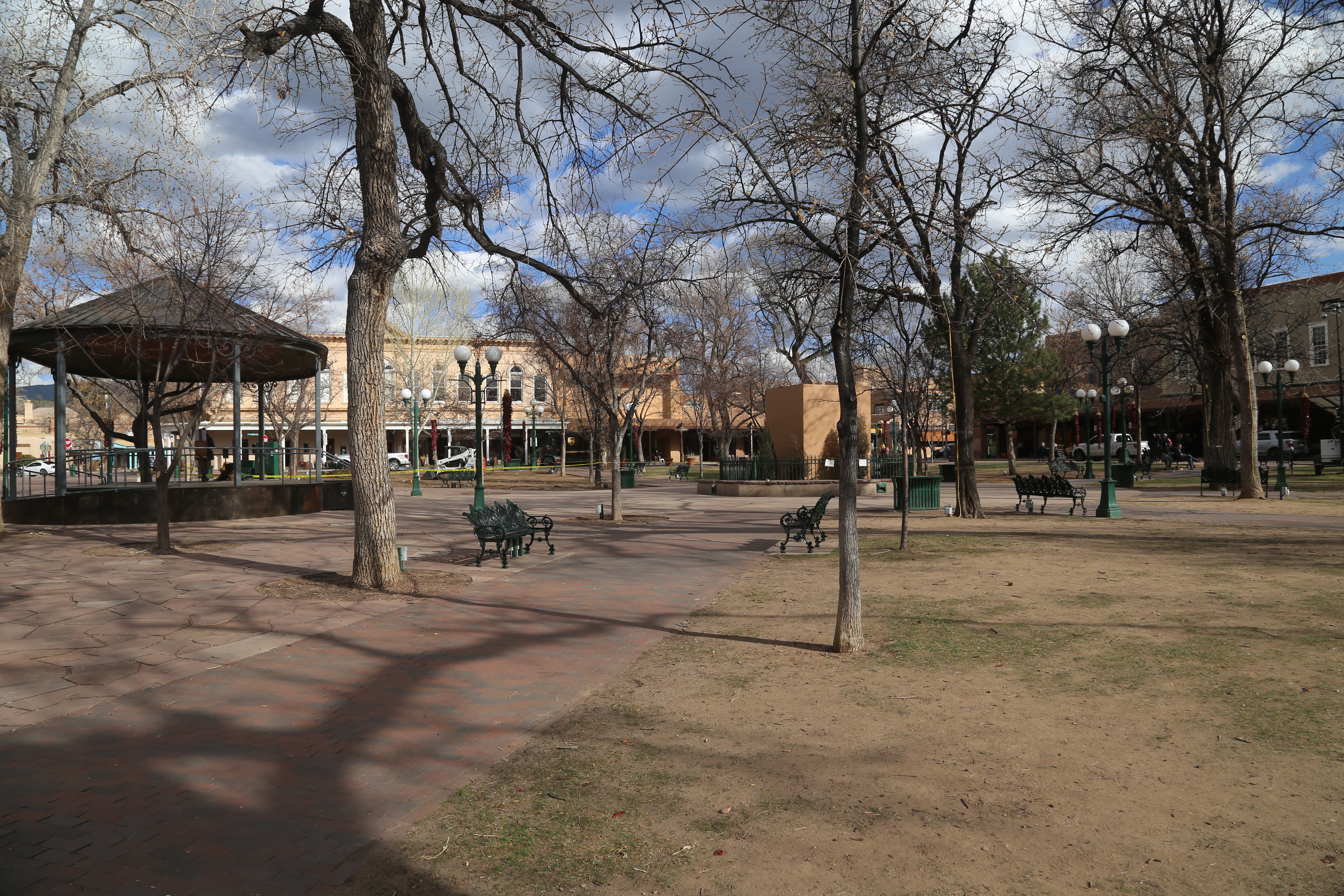
On that pedestal just to the right of center frame, there used to be an obelisk shaped memorial to the Union soldiers who fought to defend New Mexico in the Civil War. Built in 1868, it was always controversial. Not the statue itself, but one of the four plaques on the base. The plaque memorialized the soldiers who had died "in the various battles with savage indians." In 1974, an anonymous person chiseled off the word "savages."
In November of last year, an occupation of the plaza by protesters had already lasted three days. Despite the city's efforts to barricade the monument, the protesters managed to get ropes around it and pull it down. You can watch a local news report on the protest from KRQE-TV here: There's a much more in depth story from the Santa Fe New Mexican here:
Fun with shadows just off the plaza...

My home for the next two nights was the Sage Hotel. Not bad, but not quite as interesting as the hotel website makes it look. No complaints though. It was right in the middle of where I wanted to be. After unpacking the car, I simply walked around the rest of the day.


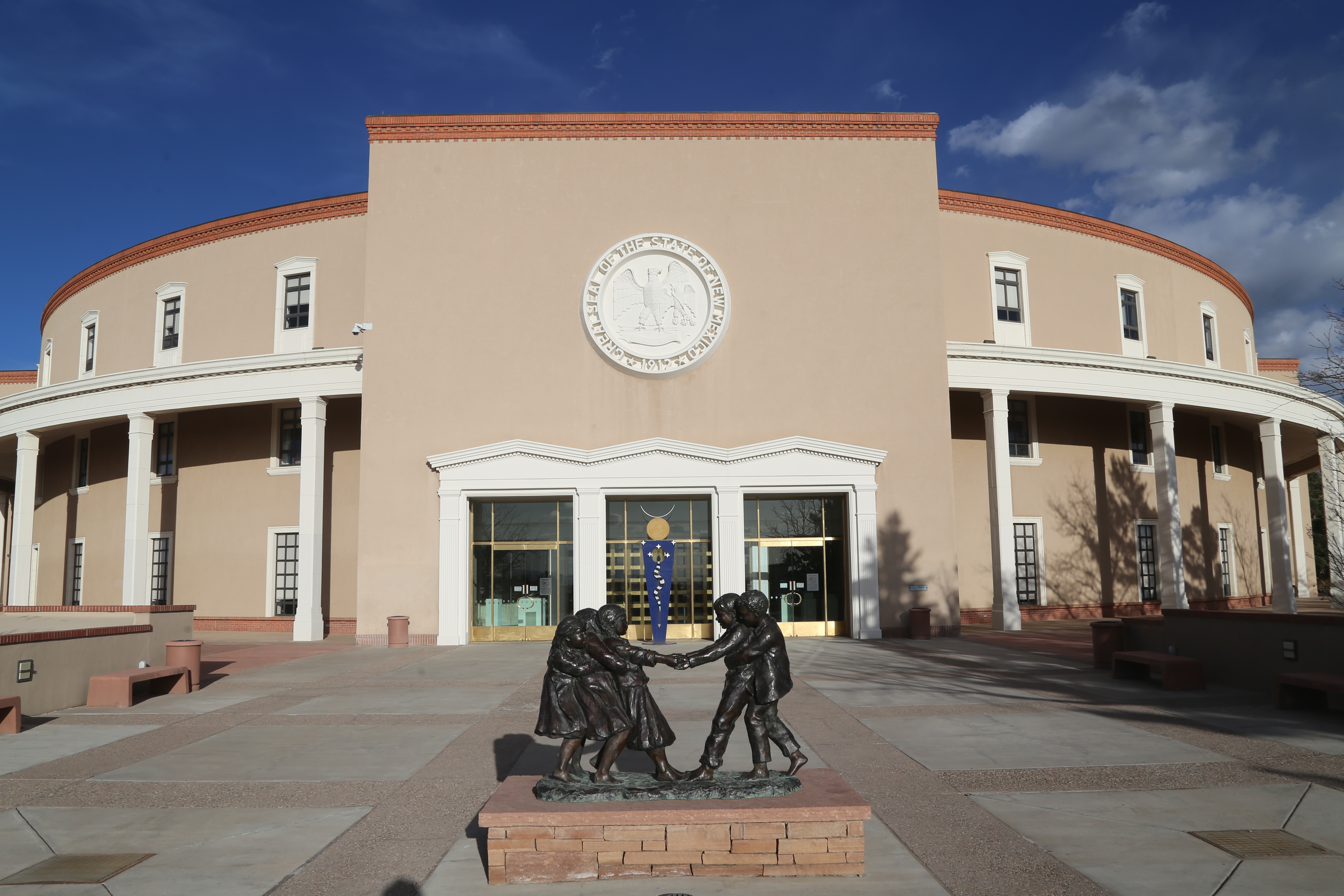
Within a ten minute walk sits the New Mexico Statehouse. For some reason I find them fascinating. I've seen a few that were quite ornate, others just seem like a generic office building. Here in Santa Fe, it's actually round.
By this point, it was early evening and too early to call it a day. So, I did a search for breweries near my location. Santa Fe has quite a few. I chose one and started walking. Close to the motel is the site of the old Santa Fe Railyard. It's now a combination public park, as well as an art and restaurant district.
I came in from the north end of the park, peeking in the window of the closed Beastly Books. I only mention it because of the mural on the back side of the building.

Just behind the building was this painted train...

It's from a company calling themselves Sky Railway. In early 2020, a group of eight investors bought the engine, caboose and passenger cars, as well as an eighteen mile stretch of track between Santa Fe and neighboring Lamy. The original line was built in 1880 and needed some work shoring up bridges replacing work track bed and clearing what they new owners described as "monster weeds."

They opened for business in November and offer quite a few various themed runs. Click on the link above, then the one on the site for Tickets. You can also charter it for private events as well.
Tucked behind is Santa Fe's regional commuter rail.

Two blocks up and I was a 2nd Street Brewery. Yeah, I hit quite a few of these on this trip. Good food, excellent beers and interesting conversations with some locals.