Monday, November 9, 2020
The first order of the day was to check the weather. If Tuesday was a sunny day, I'd book another room further west and extend the trip. Since multiple sources called for rain the next day, I packed up the room and started out nice and early.
Recently, I read about the views from Bell Mountain in Hiawassee. There are platforms atop the mountain with a 360 degree view. It's an easy twenty miles north from Helen on Hwy 75 and Hwy 2. In hindsight, perhaps I should have visited a little later in the day, even if it meant a bigger backtrack. As I drove up Hwy 75, I experienced some light mist, steady rain and the occasional patches of fog.

Something told me to keep going. Eventually, I did make it to the turnoff for Shake Rag Road and started up the mountain. This is the kind of road I really dislike. Imagine a one lane road with few pullouts. Now imagine a whole series of tight, blind turns. Then, add to the mix the fact the road was so steep at a few points, I could really heard the car straining. But, at least it's pave the whole way.
There are quite a few homes up this road. While isolated with a killer view, I'd hate to drive this road on a regular basis. I couldn't imagine attempting it in snow.
This sign greets you as you approach the final stretch...

At the end of the road there's nice parking area that might hold perhaps fifteen cars, tops. As for that sign, few seem to take it seriously.


From the parking lot there are some stairs to a series of overlooks. What a view...


The old adage is true, what goes up, must come down. Even with the car in low gear, the drive down was a workout for the brakes. And yes, I did meet two vehicles headed up. For the first, there was a convenient pull out. For the second, I backed into someone's driveway.

It felt good to be back on the main road in Hiawassee again. But, where to next? There are a number of state parks up here. I had passed Moccasin Creek on the drive to Helen. There was also Smithgall Woods. I chose the latter for obviously reasons that will reveal themselves shortly.

From the parking lot, there's a pretty easy mile and a half loop trail with plenty of identifying markers for the local plants and animals. Based solely on the amount of cobwebs I encountered, I must have been the first up the trail for the day.


On the back end of the trail, a nice gap in the trees...


The trail loops back to the parking lot. There are another series of trails within the park, some still not cleared after Tropical Storm Zeta. They all start and end along the park road. The road itself is paved, but closed to all non-park vehicles.

All in all, a pleasant walk down the road to Bay's Bridge, named after Tulane Professor Elizabeth Smithgall Watts.


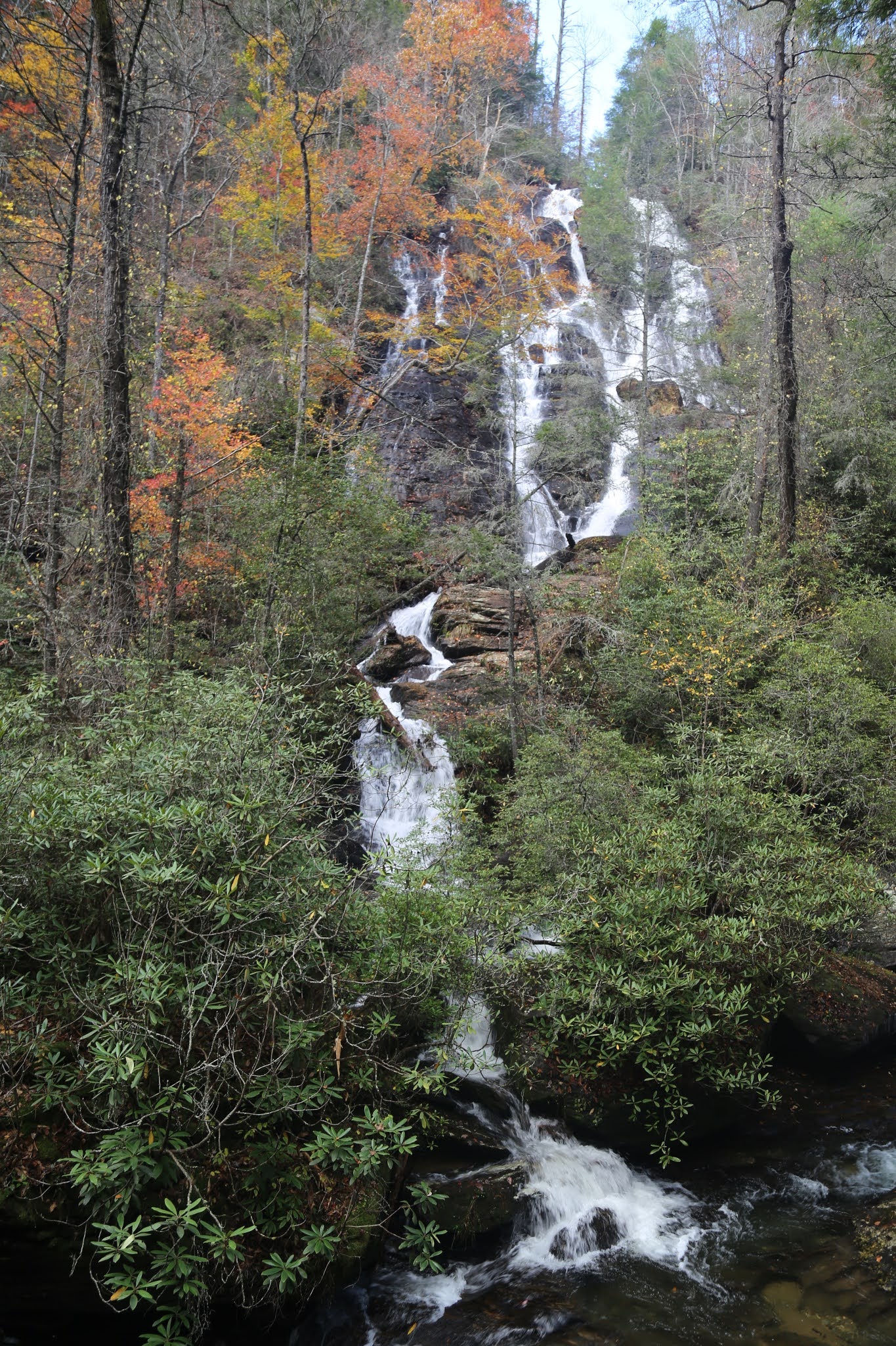
The park sits on Hwy 75 Alt. Almost directly across is the road up to Dukes Creek Falls. The trail from the parking lot is one mile. It's partly paved, part gravel, part simply packed earth and part wooden walkway. All in all, a pretty easy mile.
First glimpse of the falls...


And eventually down to the falls...


Not a bad way to wrap the day, and a quick roadtrip.
David
11/20
PS: While there's nothing planned or set in the near future, there are still plenty of state parks to visit. This trip was a lot of fun, and I may just do it again soon.
No comments:
Post a Comment