Day 6
Thursday April 7
Today was all about El Malpais National Monument. Native Americans crossed the park's lava fields, leaving petroglyphs behind. When Spain expanded into New Mexico, they simply went around, referring to the area as The Badlands, thus the name.
It's an area of sandstone cliffs, wide lava fields, lava tubes(closed due to Covid-19) and the second largest natural arch in the state. I had three trails chosen for the day and decided to get an early start.
Yes, this is accurate...
From Grants, El Malpais is one exit east on I-40, then south on Hwy 117. Even if you're just driving through, it's worth the detour...
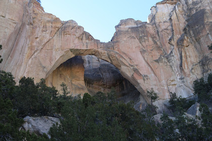
The first stop of the day was the trailhead for La Ventana Arch. The trail is only a quarter mile, gravel and relatively level. There was a time you could walk right up to the arch. Erosion and the occasional rockfall forced the Park Service to limit how close you can get.
There's a section of the park they call The Narrows. It's the thin strip of land between the cliffs and the lava field. It's wide enough for a road, just not much else. That's where you'll find the Narrows Rim Trail. The initial climb up to the top of the cliffs wasn't too bad, you just had to watch your step. Afterwards, it's a four and a half mile hike across a trail that alternated between a rocky, loose sand and compacted earth surface. Not bad at all, and I was able to set a decent pace. At the end of the trail is an overlook of La Ventana Arch. Then there's always the four and a half mile hike back to the car.
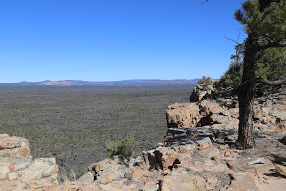
The view from the top of the initial climb up...
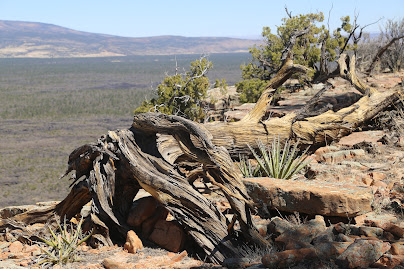
Along the trail...
That lava field covers an area thirty-five by sixty miles. In the early days of WWII, a remote section was designated as a bombing range, with flight crews dropping low powered and practice bombs. The Army Air Corp moved the range simply because it was difficult for ground crews to get to. After the war, the area was open to the public. After unexploded ordinance was found, it's now off limits. The field was also one of eight sites in the running for the testing of the first atomic bomb.
La Ventana Arch from the overlook at the far end of the trail...
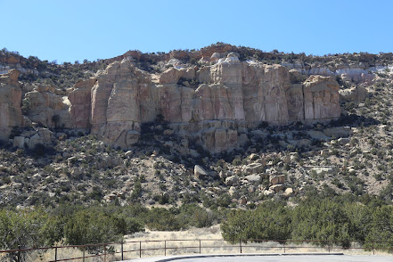
One last stop within the park. There's a place called Sandstone Bluffs. which is exactly what it sounds like. There's a long trail along the bluffs, including another, significantly smaller arch. As soon as I stepped out of the car, I knew it would be a short visit.
Granted, the wind was whipping in from the lava field and not towards the cliffs, but it was gusting hard enough that walking a straight line was difficult. So, I cut the visit fairly short.
On the way out, I thought about the changing light on the arch from this morning and decided to head back. From the parking lot, that bluff is where my earlier hike ended.
Not a bad way to spend the day at all. Driving back towards Grants, I decided to visit the other brewery in town, Elkins Brewing Company. It sits near the interstate, and adjacent to an RV park. The beer was good. But, as I had been warned, the place was pretty dead. However, I did have a nice chat with a retired couple from Flowery Branch, Georgia.


No comments:
Post a Comment