Friday April 19, 2019
It was a welcome sign to see some colors on the horizon as I started packing the car. It never developed into much, but there wasn’t a cloud in the sky. After the previous day, this was a good thing. All that was on tap for the day were three relatively short trails and a bit of a drive.
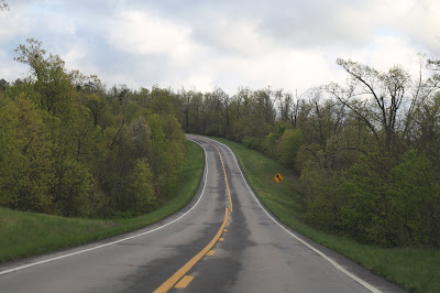
The Russellville Clarion sits at the base of Hwy 7. A straight line drive would get me to my goal in about an hour and a half. Naturally, I went the long way around. I was much humored by the numerous signs warning of “crooked and steep” conditions. Apt, but not the wording I expect to see on a road sign. Much of the first leg of my drive looked like this...
Hwy 16 East would lead me to the trailhead for Pedestal Rocks. The trail I took was a 2.2 mile loop. Long stretches of the trail were muddy and in quite a few spots it had become a small stream. Considering how much rain we had the previous day, I wasn’t that surprised.
Eventually, you get to the good stuff. It starts with these rock outcroppings. There are numerous signs warning people not to get too close too the edge. Add some wet moss to the mix and I got their point.
Eventually, the trail would get around to its namesake, the Pedestal.
A little further along the loop, a natural bridge...
And a small waterfall...
Back at the car, I backtracked to Hwy 7 and continued onward. I was looking for the turnoff for Hwy 16, the first part of the big loop. Just after the turn is the road back to Alum Cove. From the picnic area, there’s a one mile loop trail out to a waterfall(in season) and a big natural bridge.
The overlook to the falls is atop the bridge. I didn’t know this at the time.
From there, you can take a trail down below the bridge.
Back to the car and back out on Hwy 16. I quickly came to the town of Deer. To settle my weird roadtrip craving for coffee, I stopped into a small convenience store. Coffee was free. But, there was a donation jar for the coffee pot.
The clerk asked where I was headed. I told her I was going to the Lost Valley Trail. That’s when she told me it had just reopened the day before. There was even a front page story, above the fold, in the Newton County Times. Sometimes you do get lucky. I even bought a copy of the paper. I'd hate to have arrived and found a barricade. She then told me there had been a problem with auto theft in the parking lot by the trailhead. Tow trucks would arrive, hook up a car, take it to the crusher and sell it for scrap. Apparently, the previous sheriff didn't have a problem with taking cash to look the other way. He had been voted out and the new sheriff had cracked down. They did manage to make arrests just before the trail closed.
I continued my loop to Hwy 21 and eventually Hwy 43 to the parking area. The Lost Valley Trail is the most popular in the state and for good reason.
The parking lot was fairly empty when I arrived, and yes, if there's such a thing as a new parking lot smell, this one had it.
The first half mile of the trail is nice and wide with slow hills.
Even the stone stairs are wide and fairly even.
The first highlight of the trail is a natural bridge. Unlike most, the hole was still relatively small.
Further along, you get to Cob Cave. It’s basically a large rock overhang, named after the very old corn cobs researcher found there.
At the far end of the trail sits Eden Falls.
Back at the car, the large parking lot was filling quickly.
I had met another hiker who told me about a trail just up the road. The views are supposed to be spectacular at the end. Unlike this one, it’s pretty rugged. I considered it, and would probably have attempted it if I had started earlier in the day. Instead, I picked up Hwy 74 towards Jasper.
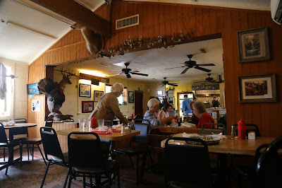
That’s where I came across the Low Gap Café. I’ve had good luck with places like this. So, I pulled off and went inside.
The menu was eclectic. They had all the usual comfort foods. But, it was the rest that got my attention. I could have ordered a catfish poboy. I could have ordered frog legs. I could have even ordered duck. I chose a shrimp poboy. This was not by any means a Maine style poboy. It came with coleslaw inside the sandwich, and the bun had a light layer of tarter sauce. It was an interesting mix of flavors and quite good.
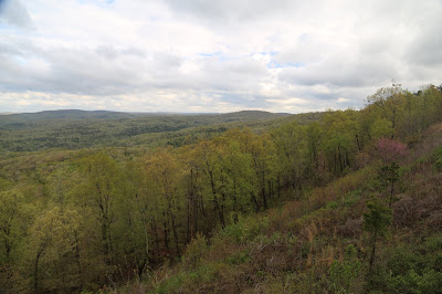
The outer lane of Hwy 74 had some long washouts, necessitating those temporary traffic lights for one way traffic. No problem. The view was just fine.
Eventually, I would get back to Hwy 7, heading south. I was looking for the Cliffside Inn and restaurant. This was my home for the night. The view was so worth it. The back deck overlooks the deepest canyon in the state.
The other sign claims this to be Arkansas' Grand Canyon. I've seen the real Grand Canyon. I've hiking in Georgia's "Little Grand Canyon." I've even been to Mississippi's "Grand Canyon." Yeah, not so much...
Coming Up on Day 6,
Another spur of the moment decision and Lil' Abner
Coming Up on Day 6,
Another spur of the moment decision and Lil' Abner


No comments:
Post a Comment