Friday April 26, 2019
The original plan for the day was a lengthy hike in the Rockpile Mountain Winderness. But, the more I thought about it, I just wasn’t feeling it. I still had a couple of hours to drive, too. If I had one more day in Farmington, I definitely would have done this,
Instead, I took Hwy 32 east to yet another State Road C. This would take me to Hickory Canyon. There are two hikes from the pullout, totaling three miles. The first was the shorter trail, but with the nicer payoff. Thanks to all the rain, the trails were muddy, but the waterfall had some nice volume.
Across the road is a loop trail back into Hickory Canyon. It wasn’t a bad hike at all, just muddy. I could have done without all the stream crossings though. Some were easy. With the rain, many of the usual stepping stones were underwater. I just had to go a little further upstream or downstream to find a better crossing.
But first, I had to check out a curiously triangular building up ahead. It used to be a part of the Triangle Inn. Now it’s a union headquarters.
Hwy 61 would get me one town south to St. Mary’s. That’s where I saw a sign for Kaskaskia Bell State Historic Park. I had actually heard about this place. It’s a small island on the Missouri side of the Mississippi River. The town was original incorporated in Illinois. The river shifted and moved, making Kaskaskia closer to Missouri. But, it's still considered Illinois.
In what constitutes downtown Kaskaskia, there's this small building next to the church.
You can't actually go inside. Press the green button and the door opens, leaving a barricade. Hit the doorbell and you get a history of the bell.
The bell was presented to the church by King Louis XV in 1741. The area was controlled by the French and referred to as New France. Still being on the eastern side of the Mississippi River, the land was ceded to England after the French and Indian War. On July 4, 1778, George Rogers Clark took the town from the British. The bell was run in celebration and it picked up the nickname, Liberty Bell of the West.
Back across the bridge and onto State Road H. As the saying goes, it made all the difference. There’s just something about driving through rolling hills in farm country.
Shortly after turning onto yet another State Road C, I came to this curious chapel in Perryville. I had never seen one without walls.
By the time I came to the town of Fronha. It was original German immigrants simply shortened the name from their home town Neiderfronha. Choices for food out this way were few and far between. So, I decided I'd stop at the next place, no matter what. Unless of course it's a chain restaurant. That brought me to the East Perry Pub.
The menu was exactly what you'd expect. The chicken Philly was pretty good actually. The beer list was simply Bud, Miller and Coors. Seen from the drive out...
My home for the night was the Townhouse Lodge, an older motel with even older wifi.
After ditching the car downtown, I took a stroll. There's a long wall protecting the town from the river. Their history is related in a series of murals.
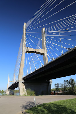
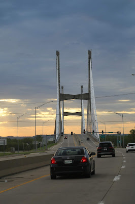
They also have one, very cool bridge.
I had nothing against Cape Girardeau. But, in hindsight, I wished I had booked two or three hours further down the road.
Day 7
Saturday April 27, 2019
Packing up the car and heading out with the sun...
Crossing back into Illinois...
According to Google, my drive time to Frankfort would be five hours and fifteen minutes. Factor stops for gas, coffee, stretching my legs and random photography, I was counting on six. I was meeting my good friend Connie for lunch and was aiming for 1P. I didn’t quite make it.
Seen along Hwy 416...
This would take me to I-57 North and I-64E. It was speed limit conditions most of the way with only a couple of short construction slowdowns. We were meeting for lunch at a place called the Brown Barrel in the town of Midway, Kentucky.
I arrived in Midway shortly after 2P. Connie lives a few minutes away and it just felt good to be walking about.
We lingered for quite a while catching up. But, I knew I had a long drive ahead. So, we said our good-byes and I headed south. It was still mostly speed limit conditions the rest of the way until Atlanta. It’s never good when the squeeze five lanes into two.
Driving through southern Tennessee, I kept glancing west. There was some pink on the horizon as sunset approached.
On one large curve in the road, the lower half of the ski suddenly illuminated with a wall of almost perfect fuschia. It was all but gone by the time I took the next exit.
With a quick stop at the grocery store, I was finally home around 1A. Was the detour worth it? Of course. Next time I’ll just plan it better.
David
May, 2019


No comments:
Post a Comment