The saga of the CR-V continues. One of the Allstate folks called the day before. With spotty cell service at best, I didn’t get the voicemail until it was too late to even try and call back. So, I lingered at the motel and called in the morning. The rep is out of the office until Monday. On a happier note, they did indeed set me up with a rental from Enterprise. I just wouldn’t be able to pick it up until Monday. This was really getting old.
The morning was supposed to have been a trip back to south-eastern Minnesota to do some hiking in Blue Mounds State Park. The splattering rain and the later start changed all that. Instead, I just started driving. Just a few miles west of Sioux Falls, I picked up Hwy 38 west to Hwy 81 North. In Salem, there’s a convenience store at the crossroads. I went in for coffee. I could have come out with a few boxes of ammunition. Interesting place.
Hwy 61 would dead end at Hwy 34. That’s where I saw this…
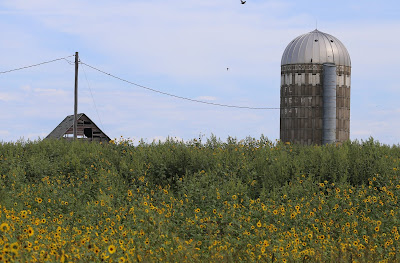
Eventually, I would pick up Hwy 25 north. In Carthage, I saw this barn in the distance and had to turn around.
Alongside the road, another sign depicting a movie site. This time for the film, Into the Wild.
See on a random side road...
For days I had been hearing radio ads for the town of DeSmet, named after Jesuit Missionary Pierre DeSmet. On the backside of town site a museum dedicated to the books of Laura Ingalls Wilder. Her father Charles moved the family here from Wisconsin in 1879. Having never read the books, I didn't feel the need to visit the museum. I had pulled into town for lunch, so I drove back and took a few pictures anyway.
Lunch was in an interesting little place downtown called Ward's Bakery. It's a combination restaurant, bakery and general store that features local food and art. A pair of reporters from KSFY-TV did a profile of the shop. You can watch that here:
From DeSmet, Hwy 25 took me north, eventually passing through the town of Bradley. If I was driving a Jeep, I probably would have taken this road, at least to the rise, just to see what's back there. But, a rental...probably not a great idea.
This route would lead to the turn off for State Hwy 36. Turning west, the road loops around Horseshoe Lake, where once again I found myself annoying the wildlife...
Seven miles brought me to the town of Lily, population 4.
Seen around Lily...
The drive north on Hwy 25 would eventually cross Reetz Lake. This wasn't the last farmhouse I would pass that's been swallowed up by a lake...
A few miles further sits Fort Sisseton State Historic Park. President Lincoln orders a string of forts established within the Dakota Territory in 1862 to support settlers in their ongoing conflict with the Lakota Sioux. Originally named Fort Wadswoth, the military realized they already had one by that name. It was renamed Sisseton in recognition of the Sissetowan Sioux who lived in the area.
One more stop to make. On Hwy 10, west of Sisseton, you'll find the seventy-five foot tall Nicolette Tower. The structure was named after French explorer Joseph Nicolette. Beginning in 1836, he made three trips to explore Minnesota, Iowa and the Dakota Territories. He used his skills as a former math professor to create maps that were considered the most accurate of the day.
From the tower, it should have been a straight shot east on Hwy 10 to the Sisseton Super 8. The motel’s listing simply said, right on Hwy 10. I wasn't counting on the construction. Large sections of Hwy 10 in downtown were being dug up. Sure, there was a detour. But, I had no idea where the motel was in relation to the detour. With no cell service and no one broadcasting free wifi, I went to Plan B.
I parked the car and walked into a Wells Fargo Bank. There were no other customers, so I told them I’m a customer in need of assistance. Kathy couldn’t have been more helpful. She wrote out directions, complete with a few landmarks. I wound up back on Hwy 10, right across from the motel.


No comments:
Post a Comment