Driving from Wall, South Dakota to the state capital Pierre(pr; Peer) can be done in less than two hours. Speed limits on the interstate are 80MPH. Today, it took nine. That's including a few stops along the way, a few surprises and a lengthy conversation with two farmers about humidity.
After breakfast, it was time to head out. One interstate exit east of Wall, I picked up Hwy 14, another direct route to Pierre, just not today
A while back, I began a self-imposed rule, if you see something and you think it might be interesting, turn around and go back. Sometimes, it’s nothing. But, when it’s something…
The obviously abandoned grain elevator is what caught my eye. When I stopped to take a shot, there was so much more. In the back of town stands what was once the town church. When the railroad was creating towns on regular intervals, each had one church. When Cottonwood was laid out in 1906, it was no exception.
Back at the grain elevator, a casual walk around revealed one side to be wide open. I thought I had the place to myself. I’m not sure who was more startled, myself, or the barn owl who flew off with much noise.
The next big town to the east is Phillip, created by the Chicago and Northwestern Railroad and named after James “Scottie” Philip. Philip was a local rancher. In 1899, he bought a herd of seventy-four buffalo from a neighboring rancher in an attempt to save them from extinction.
The local school’s sports teams are named The Scotties in his honor.
The next stop along Hwy 14 was the town of Midland, situated equidistant between the Missouri and Cheyenne Rivers, thus the name. Nine miles east, down a dirt road are the remains of the town of Capa. This was the next goal of the day. Knowing I wouldn’t have wifi, I drew out a map, complete with side streets and a few landmarks. Yet, somehow Main Street dumped me back out on Hwy 14.
Fortunately, the fine folks at the Stroppel Hotel have open wifi. While enjoying the shade by the side door, I was able to locate the turn off I had missed. About a mile away, the sign for Capa Road. Capa was another railroad town, created in 1906, by the Chicago Northwestern Railroad. At it's peak. Capa had a population of three hundred. When the railroad failed and the interstate was built further south than originally expected, Capa began to die. It didn't help that it's a seven mile drive along a dirt road just to get there.
One man still lives in Capa. Philip O'Connor lives in the same house he grew up in. I actually saw him as I drove through. He waved and went into his house. I pondered knocking on his door.
Up on the hillside site what was once Capa’s nicest hotel.
One of the travel blogs about Capa mentioned an old bridge about a mile further.
Seen on the drive back…
By now it was about that time for lunch, especially considering the less than inspiring breakfast at the motel. The only place that seemed open in town was the Midland Food and Fuel. It’s a gas station, convenience store and a small restaurant in one.
The menu was sparse, but the Chicken Philly was pretty good. They apologized for being out of peppers. I had lunch with two local farmers. They’re in the middle of harvesting their wheat and stopped in for lunch. They were watching the humidity levels and couldn't continue the harvest until they came down.
Considering how little I know about harvesting grain, I asked. Humidity levels have to be watched for two main reasons. One, if you harvest and store wet grain it tends to get moldy. Two, it also weighs more. The folks who buy the wheat want an accurate weight. Otherwise, they won’t buy next year’s crop at the full price. It made perfect sense. And now you know.
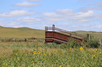
From Midland, it was south along Hwy 63 towards the interstate. That’s where I passed the first of many sunflower fields. Imagine if you can, you’re driving along a quiet highway. Suddenly, as far as you can see, fields and fields of bright yellow. Now imagine that sea of yellow flowing like waves in the breeze. It’s definitely a sight to see and it never got old. However, it doesn't translate very well to photography.
Hwy 63 would eventually cross the interstate and bring me to Belvedere. There’s an abandoned railroad bridge over the White River. I found the river and the road. One side was posted, Private Road. The other side was posted No Trespassing. Considering I couldn’t even see the bridge from the road, I drove on.
Seen around Belvedere
My home for the night was the Baymont Inn, right on the main road through Pierre. A half mile walk and I was at the state capital building. As much of South Dakota seemed to be, it was under renovation. While walking around the building, the blue construction tarps didn’t seem anything special. Only while looking at the day’s photos did they appear the same shade of blue as the afternoon sky, making for an interesting optical effect.
In downtown Pierre, there are statues of every governor from the territorial days to present.
One added bonus of the Baymont Inn, just two blocks west is a city park along the Missouri River. It seemed like the perfect place to settle in and wait for sunset.
One of the added bonuses, a swing bridge built for the Chicago and Northwestern Railroad back in 1906. It's still in use today. Unfortunately, no trains rode through while I was out there.


No comments:
Post a Comment