Day 3
Wednesday, September 6, 2023
If you drive directly from Cedar City to Kanab, it should take about an hour and a half. But, where's the fun in that?
After doing a little research on Cedar City walking trails, I found one that seemed a perfect way to start the day. It would be three miles round trip on a paved trail with few hills.
Once again, I ditched the car in Canyon Park. It's named after Ann Gardner, a former City Planner who designed and promoted the creation of these trails.
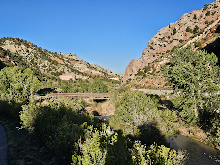
The view from the trail as it parallels Hwy 14...
The goal for the morning was the trail's end at a man made waterfall on Coal Creek. Or, as the city calls it, a "water drop structure."
The trail seems well used and I met quite a few fellow walkers, as well as a few joggers. From the walk back to the park...
Hwy 14 took me east out of town...eventually.
From one of the numerous scenic overlooks driving through the Dixie National Forest...
Navajo Lake is a small reservoir thirty miles east of Cedar City. It's a well used recreation area, just a bit quiet on a Wednesday. There's no visible stream or river flowing out of the lake. Instead, water flows out through a sinkhole. It travels underground, then out through the side of a rock.
Eventually, you come to an intersection. FR 300370 takes you into Duck Valley. There's an ice cave and I was tempted. The descriptions of the eventual road to the trailhead gave this one a pass. Instead, I turned onto FR 30054, a surprisingly nice dirt road. The folks behind the blog Utah's Family Adventure did it and posted about it.
The view of Zion National Park from the parking area.
This is where you find the trailhead to Cascade Falls. It's 1.6 miles round trip and fairly easy.
The trail ends with an overlook alongside Cascade Falls. This is the outflow from a sinkhole beneath Navajo Lake.
It felt good to be off the fire road and back on pavement again. Hwy 14 continued east and dead ends at Hwy 89. From there's it's an easy drive south to Kanab, my home for the night. But first, trail number three for the day, one named the Belly of the Dragon.
There's no trailhead signs by the road. You just have to know to take the dirt road west, just north of mile marker eighty. The entrance is visible from the parking area. You can see another hiker entering just below center frame.
It's a drainage tunnel dug through the rock underneath the road.
Once out of the tunnel, it's simply a sandy wash that leads to more side trails.
The tunnel from the other side, with better light...
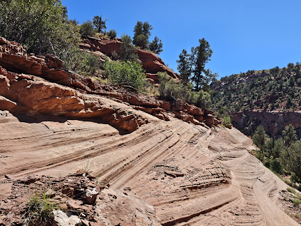
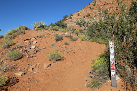
The last trail of the day was also pretty short. This time there were signs and a decent sized parking lot. The view along the trail...
I was looking for something they call the Sand Caves. It's the remnants of a short lived sand mining operation from the '70s. Seriously. Eventually, I did see the caves up on the hillside. I even watched a few people try to climb the rock to get up there. After seeing how much trouble they were having, I opted not to follow.
The family behind the blog Hiking Utah Beauty did it. You can see what I missed by not going up. Instead, I drove int Kanab, found the motel and kicked my feet up for a bit. Aiken's Lodge is your basic old school motel. Nothing fancy. But, I wouldn't hesitate to stay here again.
The description on the BLM site claimed it was a 2.5 mile loop. The description on AllTrails.com claimed it's 3.5 miles out and back. With the mile each way to the trailhead, I did another half hour up the trail before turning back. At that point, yeah, I was done.
From the walk back to the room...


No comments:
Post a Comment