Thursday, June 22, 2023
One quick story about Ontonagon, the Native-Americans had been mining for and working with copper well before the Europeans arrived. It was a symbol of wealth. Larger chunks were being passed down through the generations, some as heavy as twenty pounds.
Alongside the Ontonagon River, there was one piece the Chippawa considered sacred and a gift from the gods. Imagine a piece of copper 3,700 pounds. Rumor of the rock eventually reached French explorers. Jesuit missionary Claude Damien confirmed it's existence.
The copper boulder now sits on display in the Smithsonian Institution. There have been attempts to get it returned to Ontonagon. In 2,000, the government decided it didn't fit the definition of a sacred object. You can see an archive photo from the Smithsonian here:
I came to Ontonagon for one reason, Porcupine Mountain State Wilderness Park. It's thirteen miles west of the motel, right on Hwy 64. In between is the demarcation line between Eastern and Central time. So, it's an hour earlier inside the park. Kinda trippy.
The drive to the park takes you right along Lake Superior. This early in the morning the lake was hazy and the view not so great. Trails promising overlooks seemed a bit pointless. So, I decided to check out a few other spots first.
Outside the park is the turnout and short walk to Bonanza Falls. Austin Corder discovered silver here in 1855. A land grant had already been given to a railroad, so he had to keep it quiet until the grant ran out and he could file one for himself. He filed for the grant in 1872, then sold the mining rights.
The initial surveys overestimated the amount of silver in the rocks. After four years, the silver boom was over. It's one lasting legacy, the small community of Silver City.
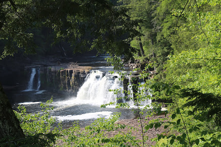
The drive through the park was certainly pleasant. The road to the far end of the park is only twenty-five miles. On the far side are trails to three very different waterfalls. After ditching the car, it's a relatively short walk to the first set of stairs down to Manabezho Falls.
Another set of stairs and a boardwalk brought me to Manido Falls
And finally, the last set of stairs down to Newadaha Falls.
I realize this isn't anything unique, but the circular holes created by erosion and time are just fascinating.
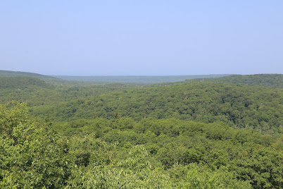
On the way back through the park, I drove up to a place aptly called Summit Peak. It's a half mile trail up to the mountaintop.
And the view from up top...
At the far end of the shoreline road is the parking area for Lake of the Clouds. A few days ago, I met a guy who positively raved about the lake. From above, I could see trails down along the lakeside. If I had more than just the one day, I would have gone off exploring them.
Instead, I chose the Escarpment Trail. My hiking guidebook promised overlooks. One end of the trail begins at the Lake of the Clouds overlook. According to the signs along the trail, this overlook is about a mile out.
I backtracked to the car and drove to the other end of the trail. The guidebook warned of a steady climb to the first overlook.
From here, the next overlook was supposed to be just a few minutes down the trail. So, I kept walking. After about thirty minutes, I ran into a guy hiking the other direction. I asked and he told me the next overlook was a mile or so away and not that great. I walked another ten minutes and turned around.
I do realize my hiking guidebook is six years old and trees do grow. But, there were supposed to be overlooks of Lake Superior. Yeah, I was a bit disappointed.
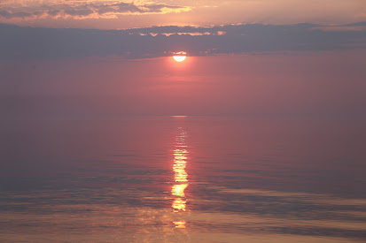
I did venture back out to the lake for sunset. With less smoky haze than the night before, I was richly rewarded.


No comments:
Post a Comment