Wednesday, June 7, 2023
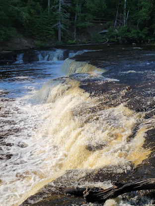
Today was all about Tahquamenon Falls State Park.(Rhymes with phenomenon) There are two waterfalls and a few loop trails, I was good to go. The park entrance for the Lower Falls is fifteen minutes outside Paradise. The Upper Falls are three miles further down the road. and significantly bigger.
I decided to start with the Lower Falls. There were workers rebuilding stairs, replacing railings, resurfacing the parking lot and even planting trees. It doesn't take long to arrive at the first overlook of the Tahquamenon River.
From here it's an easy third of a mile to the falls overlook.
Keep going and you reach a bridge across the river. You also encounter the beginning of the River Trail, a four mile walk to the Upper Falls. In season, there's a shuttle service so you only have to walk one way.
The bridge crosses over the river and takes you to a short loop trail with views of the falls from the other side.
From there you can climb down a long set of stairs to see the waterfall from ground level.
Or hike the other way to more overlooks.
Seen on one of the sets of stairs...
There's a 3.8 mile loop called the Big Pine Trail that I had wanted to do as well. I didn't get very far. The mosquitos were out in force and I was smacking them left and right.
Instead, I had an early lunch at the park's brewery.
They swore the flower on my salad was edible. As I type this, it's six hours later and I still feel fine.
By the one traffic light in Paradise, there's a sign for the Point Crisp Lighthouse. So, I looked it up. It's not on my AAA or Michigan State map. However, Google Maps does give driving directions. Intrigued, I started reading accounts of the road conditions out to the light house. This posting from the site AwesomeMitten made it a possibility. Then I read a few more accounts concerning the loose sandy sections and decided against it, at least for today.
Whitefish Bay just north of Paradise.
Since I had plenty of time left n the day, I worked my way back to Paradise and drove north along the lake towards Whitefish Point, the north-east point of the peninsula. At the far end of the road sits Whitefish Point Light Station.
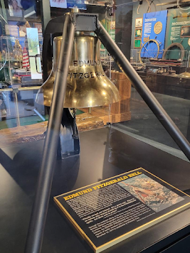
Built in 1861, it's the oldest operating lighthouse on Lake Superior and replaced the one built in 1849. It marks the end of an eighty mile lakeshore known as Shipwreck Coast. There are over two hundred known wrecks in the vicinity of Whitefish Point alone. It seems fitting this is also where you'll find the Great Lakes Shipwreck Museum.


No comments:
Post a Comment