Day 2
Sunday August 16, 2020
There are plenty of places I could have stopped for the night. I chose Mojave for two reasons. It’s cheap and it’s just a few miles outside Red Rocks Canyon State Park and right on Hwy 14. Considering it’s the middle of August in the California desert, I needed to plan my visit first thing in the morning.
Seen on the back of the car parked next to mine....
The sun was coming up as I packed the car to head north. Red Rocks Canyon was about a forty minute drive.
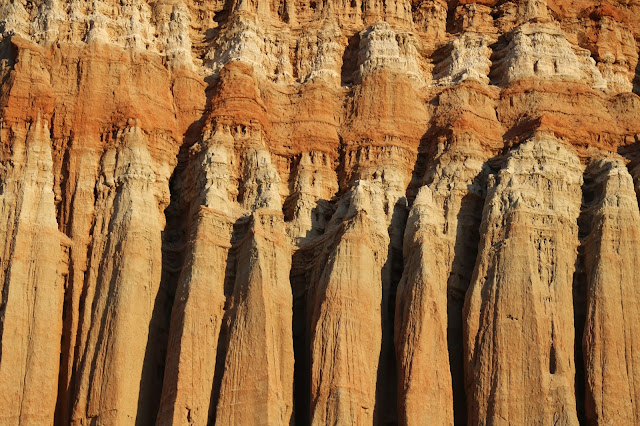
There are different section of Red Rocks Canyon. This is from a place aptly called Red Rocks Cliffs.
Just up the road is the main section of the park. Due to Covid-19, the visitor center was closed and the day use kiosk was unmanned. Seen around the park...
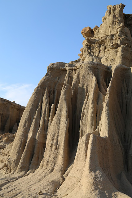
I did manage to pick up a park map, which showed some more sections further up Hwy 14. I tried one of them. The road started out as packed dirt, but that didn’t last. When I got to the split in the road, I knew it would be a stupid idea to continue. You can click here to read more about an area called Nightmare Gulch. Here's another from an area called Nowak's Opals, site of a long closed Opal mine.
A few miles north of the park, Hwy 14 joins Hwy 395. I continued north towards the town of Coso, Blink and you’ll miss the turnoff for Fossil Falls. From the parking lot, there’s a quarter mile trail out to a long dry waterfall. It’s not a long walk, but consider it’s the middle of August and you’re walking across a lava field. If it wasn’t such a short trail, I would have passed.
Yes, the road out to the parking area is indeed black.
Further north sits the town of Lone Pine. South of town is what used to be the Diaz Ranch. Rafael and Eleuterio emigrated here from Chile in 1860 and operated a successful cattle ranch. Twelve years later, their world changed in one night. At 2:30A, March 26th, an earthquake hit, estimated to have registered 7.4 to 7.9. The fault is estimated to have moved 35-40 feet laterally, and dropping the valley floor by twenty feet. In the process, a new spring was opened, eventually creating Diaz Lake
Lone Pine is also the closest town to the Mount Whitney trailhead. At 14,505 feet, it’s the highest point in the continental U.S. When I had previously researched the trail, descriptions didn’t exactly seem inviting.
Recently, I came across a few newer blog post about climbing Mount Whitney. It’s a long slog to the high point, covering eleven miles each way. While a long trail, the elevation gain is spread relatively even. The way they described it, it sounded like something I could do. Being August, I wouldn’t have to pack cold weather gear or deal with snow. However, the State of California only allows sixty people up a day and permits are on a strict lottery system. I was months passed the drawing.
I was well ahead of schedule for the day, so I drove up Whitney Portal Road. Considering it was 103 degrees in downtown Lone Pine, the 78 degrees in the parking area was welcome. That peak straight ahead is Mount Whitney.
Without a permit, you're only allowed up to the lake at the three mile point. I've hike there before in mid May and there was still some ice on the lake. I didn't think I had the time for a revisit.
During my previous visit, somehow I missed the waterfall next to the upper parking area.
From Lone Pine, I continued north to the town of Big Pine. And yes, in a municipal park there is indeed one lone sequoia pine tree. The tree was planted in 1913 to commemorate the opening of the Westgaard Pass to cars. Now known simply as Hwy 168, the Westgaard Pass was first created in 1873 to allow easy access between Camp Independence and Deep Spring. As for Camp Independence, it was established in 1862 to protect miners from raids by the local Native American tribes.
The camp was located a few miles south of Big Pine, in the town formerly known as Little Pine. Since the camp was established on the Fourth of July, they named it Independence. One year after its establishment, the Camp’s Commanding Officer, Captain Moses McLaughlin gathered one thousand from the local tribes. He then informed them they were being forcibly moved to a new reservation two hundred miles south-west near Fort Tejon, thirty-five miles south of today’s Bakersfield. Preparing for resistance Capt. McLaughlin had his garrison fully armed and surrounding them.
At first light, the move began. Taking into account the lack of wagons and mid-July heat, of the thousand who started the walk, eight hundred and fifty made it to their new home. Finding the new place unsatisfactory, many simply worked their way back to their former homes.
As for Captain McLaughlin, he was called away to Camp Babbitt, in modern day Visalia. One month after arriving, Captain McLaughlin was court marshaled on three counts that boil down to graft and conduct unbecoming of an officer. Though he was found guilty and discharged from the army, every member of the court recommended leniency due to his previous service.
After his dismissal, President Andrew Johnson stated while Captain McLaughlin’s actions were improper, he didn’t believe them intentional, and thus insufficient to warrant dismissal. Johnson wrote, “It is recommended that the disability occasioned by his sentenced be removed.”
Since it was only 2P, I decided to do Tuesday’s trail. Considering the twist, turns and blind curves, the drive up Hwy 168 was pretty easy and a little over a half hour. This time the trailhead was high enough it was 72 degrees. No complaints whatsoever.
I had driven into the Inyo National Forest to the Ancient Bristlecone Pine Forest. There’s a four and a half mile loop trail through the Methuselah Grove.
Tucked in an undisclosed location within the forest, you probably won’t find the Methuselah Tree. It’s exact location is a closely guarded secret. Sadly, the rationale makes sense. It’s to protect the tree from vandals, the curious and the inconsiderate. Its claim to fame is being world’s oldest known living tree, estimated to have sprouted around 2833BC. Yes, you read that right.
Around the two mile point, the sky to the northwest started darkening. The occasional rumble of thunder didn’t help. But, when you’re half way around a loop, you can’t exactly turn around. The thunder would continue be sporadic and I never saw any lightning. So, well worth it.


No comments:
Post a Comment